Create Bloomberg Connects maps
A site map for your institution helps visitors locate objects, exhibitions, and activities—as well as cafes, shops, and restrooms—floor-by-floor and across outdoor grounds.
To ensure the best user experience, maps in the Bloomberg Connects app follow a distinct style. To create maps in the appropriate style, you can send the Bloomberg Connects Marketing team the map (or maps) of your institution and our team will redesign them. For any questions about designing your own maps, please reach out to your Onboarding Manager.
In This Article
Submit your maps
Steps
-
Ensure that you have a unique map for each floor of your institution.
The style of the map isn’t important. We can even work from a sketch or architectural drawing.
- Convert the images of your maps into PDF format.
- Mark up the PDF with necessary edits using sticky notes/comments in the PDF. If not already indicated on the exiting maps, be sure to include:
- Bathrooms
- Accessible bathrooms
- Elevators
- Stairs
- Entrance/exit
- Rooms that are off-limits to the public
- Info desk
- External streets, if applicable
-
Name of the building, floor number, etc.
Note: If you prefer to include the gallery names directly on the map to help the design team identify specific areas (e.g., restricted zones, sections, etc.), please note this as a comment on the PDF or in the submission form.
- Submit your PDF using this form.
Once your maps are submitted, a Bloomberg Connects marketing project manager will review your submission within 5 business days and email you in case they need additional info to start your request.
Note: Typical turnaround time for the first draft is 2-4 weeks, depending on our design team’s workload. Total time to complete the map is typically 6 weeks, depending on the timeliness of feedback and the number of edits needed.
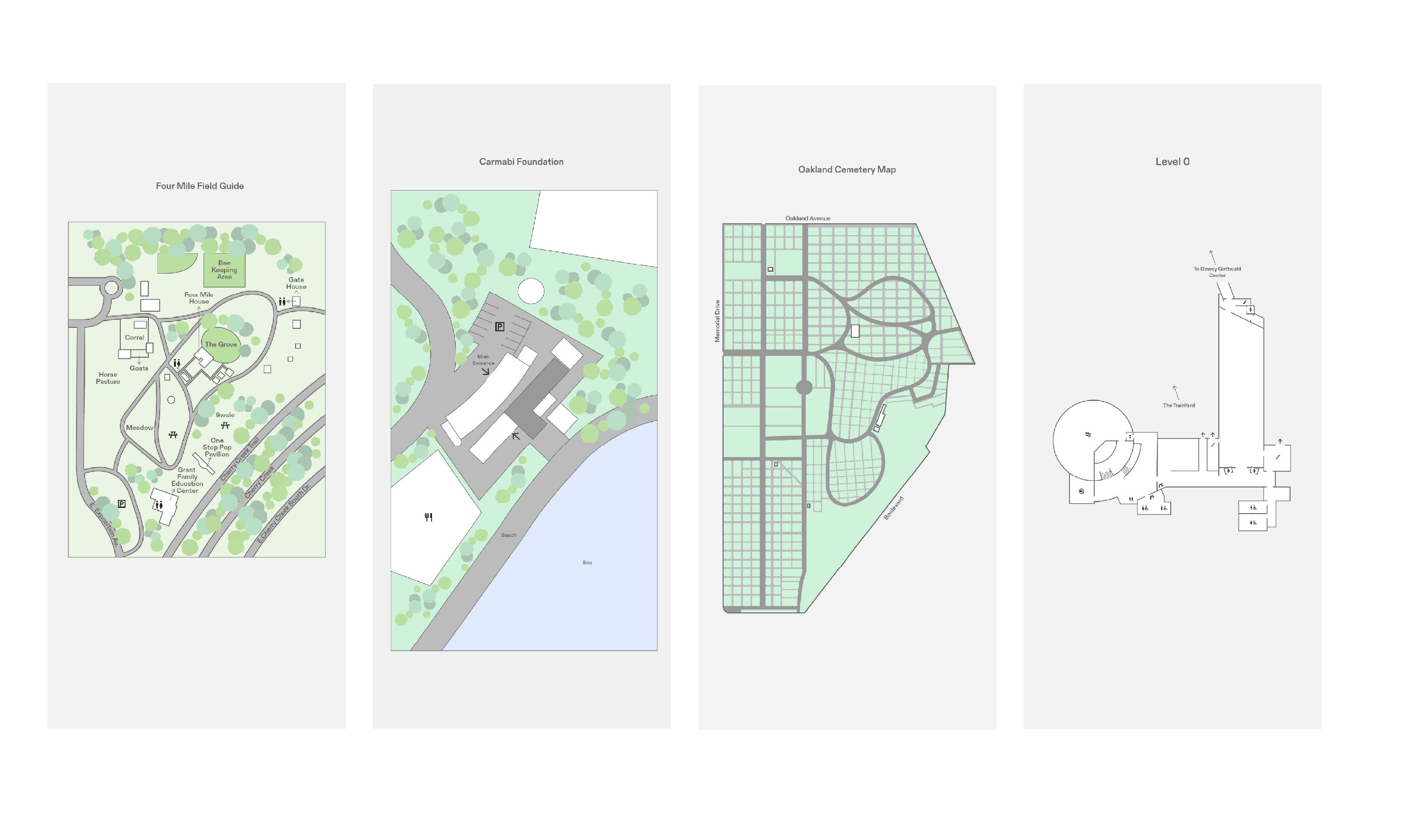
Example
To download an example of a map marked up with sticky notes, click here (.pdf).
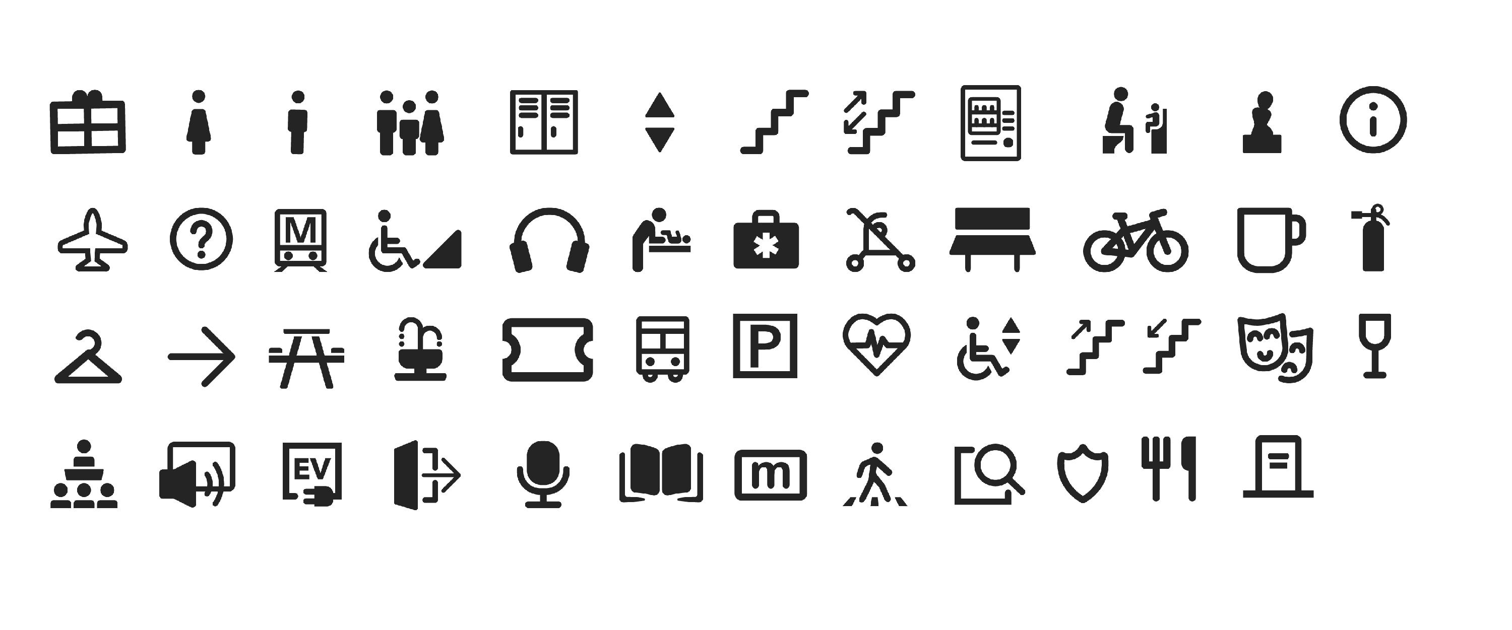
Icons
Font
The font used throughout the Bloomberg Connects app is "Connects Diatype Bold".
Colors

Text labels
Our designers no longer use text labels on maps. Instead, they recommend using pins to identify locations. Pins keep maps clearer, easier to read on mobile devices, and more flexible when content changes. We encourage you to use pins for any locations or points of interest you’d like to highlight.
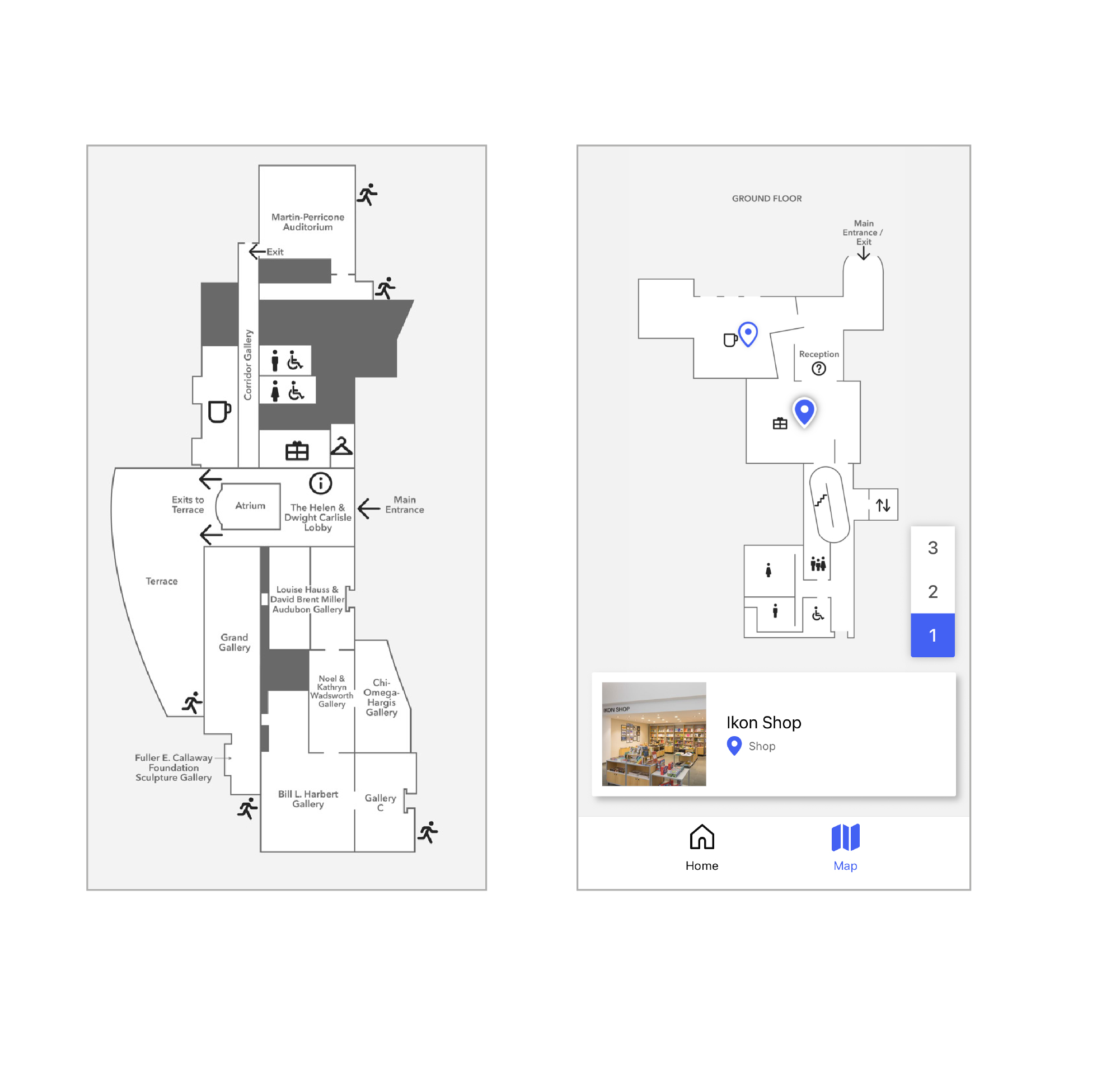
Examples