
Exterior maps
When your guide covers multiple buildings or includes outdoor spaces, an exterior map helps visitors get around.
Tip: If your facility only has one building and doesn't have any outdoor objects, you don't need to add an exterior map. Instead, you can just add your building and floor plans. For more, see Buildings.
Add an exterior map
Exterior maps let you organize your buildings and outdoor points of interest.
Bloomberg Connects uses Google Maps to make it easy for you to add an exterior map. If you'd prefer to use a static image map, reach out to your partnership manager.
Steps
-
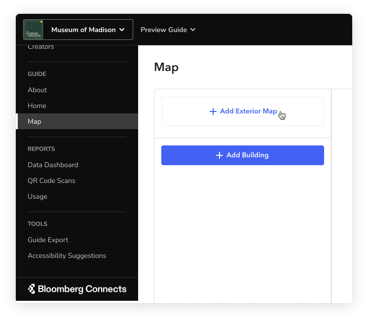
In the Guide section, on the Map page, click Add Exterior Map.
- In the confirmation window that appears, click Add Map.

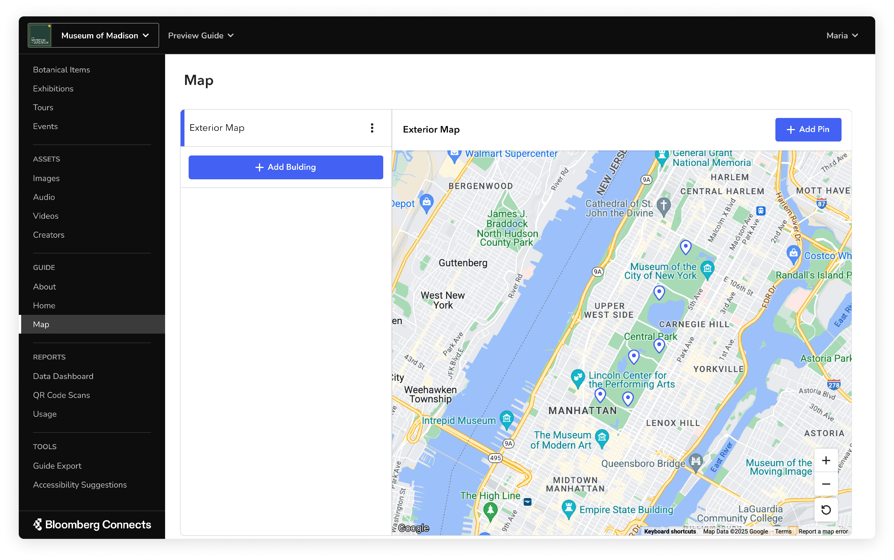
A preview of your map appears. This preview contains a lot more information than what visitors will see in your guide. Your guide’s map is a clean, stylized rendering that only shows essential information.
You can add your buildings or content pins to your exterior map. For more, see Buildings and Map Pins.
Default behaviors
A few things happen automatically when you add an exterior map:
- Your map's center point, zoom level, and orientation are determined by your primary address. When you add or move pins, the map automatically adjusts to fit your pins within the default view. Visitors can zoom on their own and navigate your map with their live location.
- If your guide includes both an exterior map and building maps, the exterior map is your default map view. This allows visitors to get a high-level overview of your space before exploring specific buildings.
Delete an exterior map
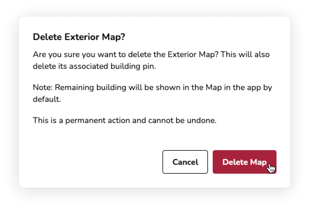
You can delete your exterior map if: 1) you only have an exterior map or 2) you have an exterior map with just one building. Once you have two or more buildings, an exterior map is required and cannot be deleted.
When you delete the exterior map, the building pin is deleted but the building (and any associated floorplans) remains.
Tip: If you want to switch from using a Google Map to using a static image map, reach out to your partnership manager.
Steps:
-
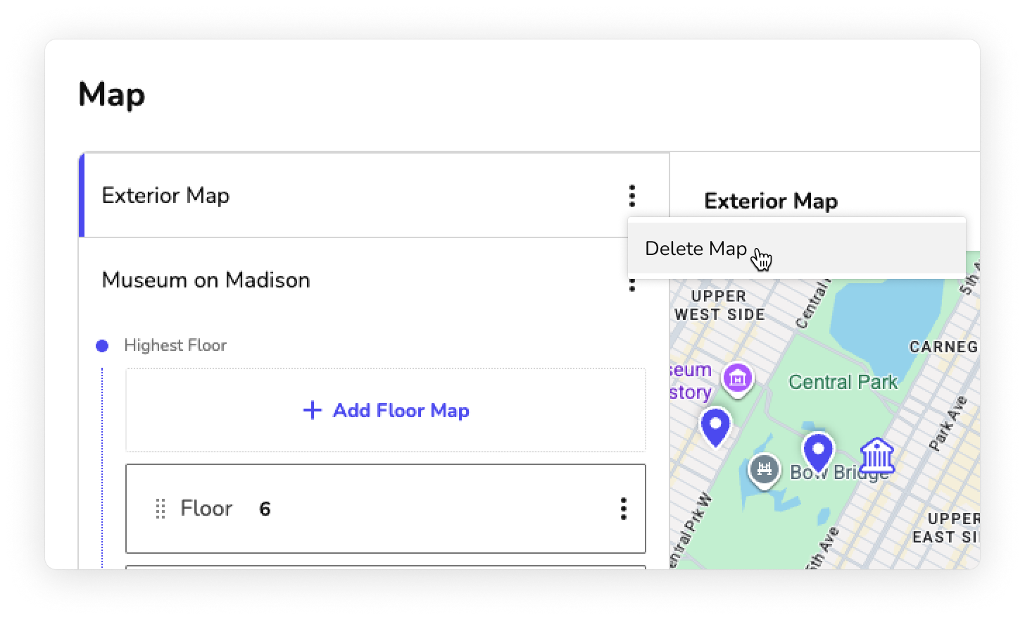
In the Guide section, on the Map page, click the more actions menu (⫶) next to the exterior map name, then select Delete Map.
-
In the confirmation window that appears, select Delete Map.
Your exterior map is deleted. Your building's default floor appears in your guide's Map tab.

